Rzvay Border Market

We had made it into Rzvay fairly late last night. The program today did continue as normal nevertheless.

Some of us (including myself) had decided, to have breakfast outside with straight views across the river to the Afghan side – but also the bridge connecting Tajikistan with Afghanistan.

After breakfast we did visit the border market on the Tajik side, offering both goods from Tajikistan and Afghanistan. Some in the group also used the opportunity to get some Afghan money as souvenir.

Khorog to Rzvay

Today we had a stretch of about 240km ahead of – from Khorog to Rzvay – and today was also the day, that someone in the Intrepid (travel company for this trip) head office in Australia had gotten very nervous.

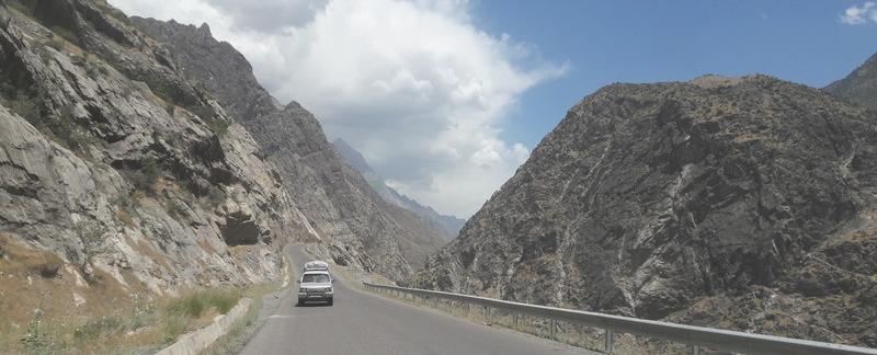
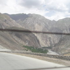
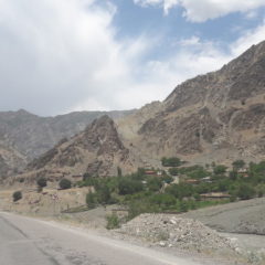
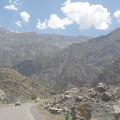
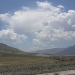
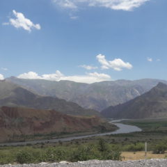
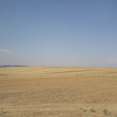
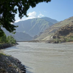
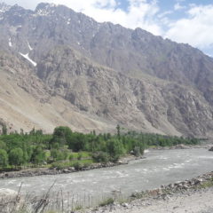
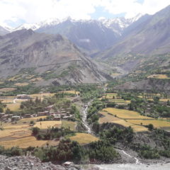
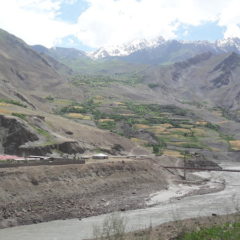
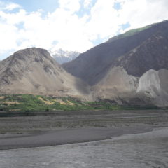
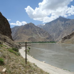
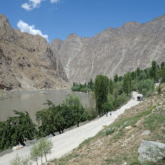
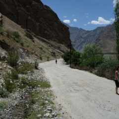
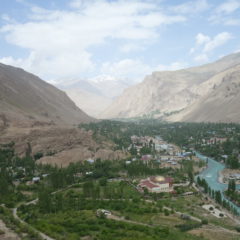
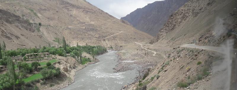
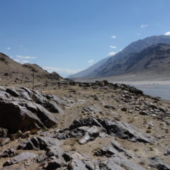
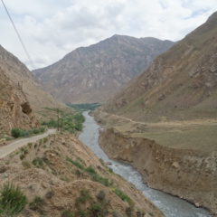
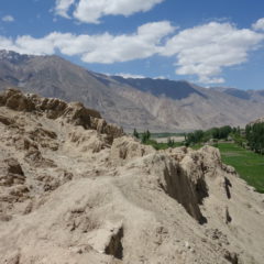
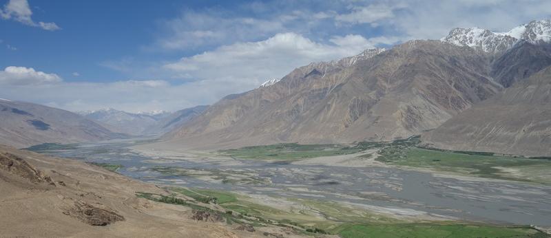
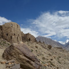
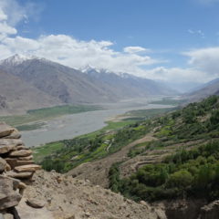
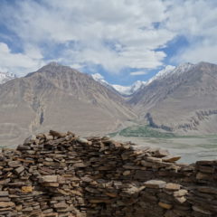
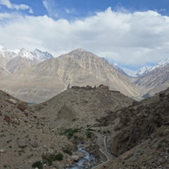
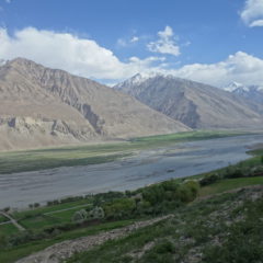
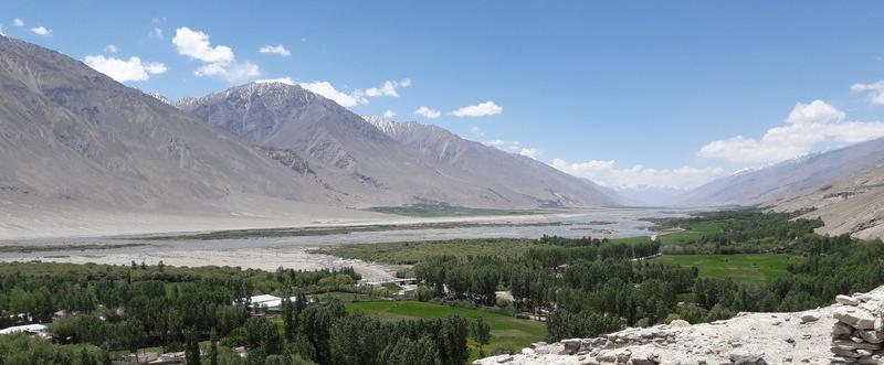
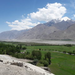
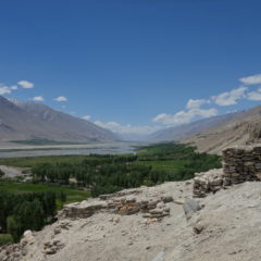
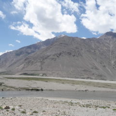
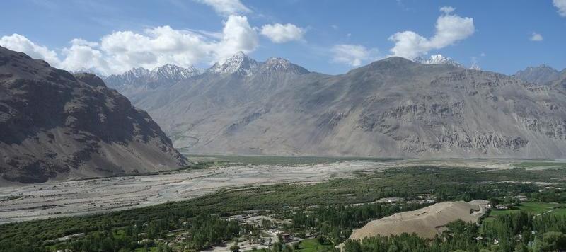
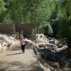
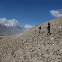
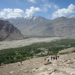
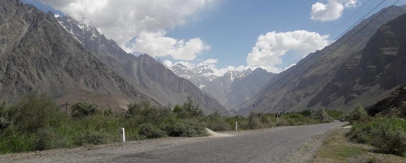
We left Khorog in the morning, made it back to the Panj river and were now heading in a Northern direction; we were now also back on the M41 road, i.e. the Pamir Highway.

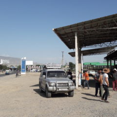
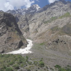
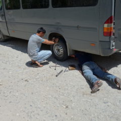
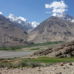
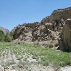
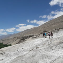
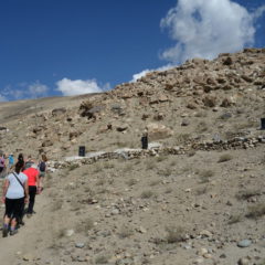
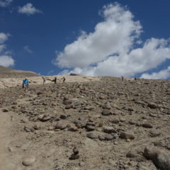
We had numerous photo stops on the way – and also a first incident, when a tire had given up and had to be replaced. This surely was no big deal; one of our replacement tires was taken out of the van and from here it was a simple replacement job – and we were back ready to go within 15 minutes.

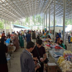
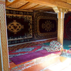
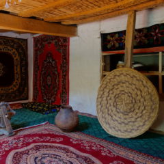
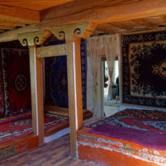
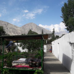
We had lunch in a nice little restaurant close to the river, the summary being: great food, but atrocious toilets.

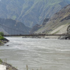
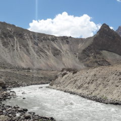
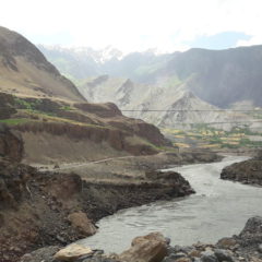
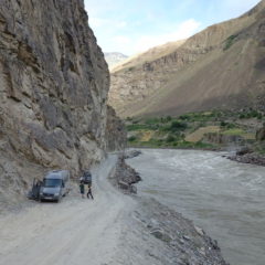
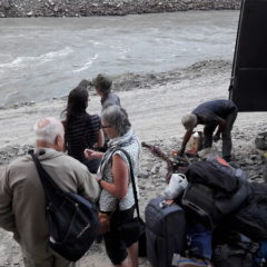
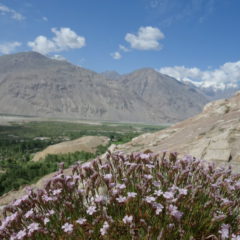
We continued along M41 following the Panj river. About 5km after the village of Lyakhsh (at 38°19’28”N, 71°13’24”E) we were hit by bad luck: while going through a bump in the road the ball bearing of the drive shaft was hit and destroyed.

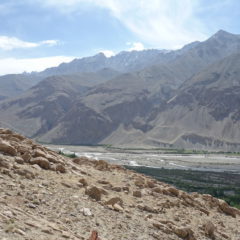
Sasha got the car of the road and went straight into trying to replace the ball bearing. And while he had an impressive collection of spare parts with us, the specific one – of course – was not included. Sasha tried to improvise, but after some hours it was clear, that this would not work … so Jam had to organize a plan B, to get us moving again. About five hours after the incident two jeeps were pulling in and we were soon on the move again – making our way to Rzvay in the dark.

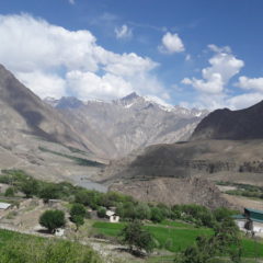
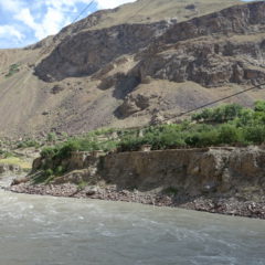
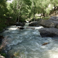
You may now ask yourself, why someone in Australia may have become nervous – right? Well … very simple … the breakdown occurred literally 50 meters from the border to Afghanistan (with just a wild river between Afghanistan and us).

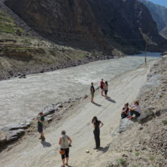
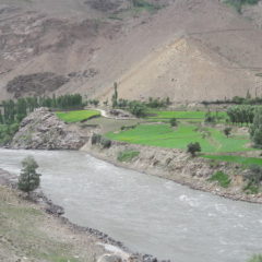
We were certainly a bit of an attraction for the people over in the village of Jamarj-e Bala on the Afghan side of the river – – despite the distance (maybe just below a hundred meters to the village) there was some good interaction here – including loads of waving.

Ptup to Khorog

We were heading back into town again today, the destination being Khorog, the capital of the Gorno-Badakhshan autonomous region with a population of 28000. A trip of overall 180km was ahead of us.

From Ptup we continued along the Panj river, had a stop at Khakka Fort on the way (see previous entry) to eventually reach Eshkashem. Here we continued North (still following the river) to – after a lunch stop en-route –  reach Khorog in the late afternoon.

Khakka Fort

En-route from Ptup to Khorogh we had a stop, to get to see the remains of Khakka Fort. The fort these days has been taken over by the Tajik military, so most of it is off-limits to tourists and only the entrance and outer walls can be visited.

Prior to the fort we stopped at a nearby museum, where the proud owner was guiding us through the collection. The highlight here was clearly the showcase of a traditional Wakhani house. Here we got a good introduction to the key features of the traditional architecture (setup and naming of pillars, setup of the roof light, resistance against earthquakes etc.) and also a demonstration of traditional Wakhani music (played on a traditional instrument). Overall an informative and worthwhile stop.

Yamchun Fort

We left the homestay after lunch for – what turned out to be – the highlight of the whole trip for me. We made our way up the mountain side … and further up … and – well – further up – until we could see the first stop of this afternoon excursion – Yamchun Fort.

Yamchun Fort sits on a cliff well above the Panj valley … at – I would guess – a good 400m above the valley floor. The fort clearly offers some of the – if not the – most stunning views of the whole trip … covering the valley and beyond into the Wakhan corridor.

While all sources agree on the stunning setup of the fort, there is quiet a bit of dispute regarding its history. Some sources see the fort as going back to 300 BC with it playing major role in silk road history, while other sources associate the fort to the 12th century AD only.

In the end for me, the age of the fort did not matter … walking around the premises and taking in the different views and angles certainly was a key highlight of the trip.

Another highlight was waiting for us after the visit of the fort. We were now continuing on the same road, we had used to come up – and made our way further into the mountains. After a drive of about 15 minutes we had arrived at our destination – the Bibi Fatima hot springs.

For the locals (especially the women) bathing here has a purpose, as soaking in the hot water here for women (supposedly) has a positive impact on her fertility (I just hope, she does not send her husband to bath in parallel, as the hot water would certainly have a negative impact on his near future fertility). For us though, the hot spring was a basically a very welcome bath after days of travel on dusty roads with only rudimentary shower options … also add to that the relaxation effect of the hot water – and you have a winner 😉

Vrang Buddhist Stupa

Our next stop en-route was near Vrang village.

We left the van and made our way through a flowering meadow towards the mountain slope. A few jumps over irrigation ditches and a bit of an uphill scramble later we were standing on a small plateau, overlooking the Panj river valley – and next to Vrang’s Buddhist Stupa (as it is commonly called).

To me the stupa resembled a small stepped stone pyramid – and really had nothing in common with any of the Buddhist stupas, I had seen anywhere in Asia. To me something did not add up here. In retrospect (and some museum visits later) my gut feeling is, that this may well have been a Zoroastrian place of worship … be it towards the heaven (air) or as a fire temple. The stupa may also indeed represent an odd mix of both Buddhism and Zoroastrianism. Indeed over the millennia both religions had made their pass through the region (with some influence still present today) – so my gut may well be right … but then – I leave any conclusions to those with a proper background on history and religions.

What I can say though, views were once again amazing. This time we were not as high as earlier on today, however the river was bigger now, with loads of green around the shores – so there was no need for a vantage point from high above.

Oh … and also … there were some amazing shopping opportunities here … from hats all the way to precious stones – a new pendant anyone?

Langar Petroglyphs

Today was to become an active day – and as such a welcome change to the previous days, which were mostly spent driving.

Our first activity was a hike literally in the backyard of our homestay; the van took us for the three minute trip to the trail head, from where we started a walk up the mountain, first passing by the village cemetery – until we eventually hit a petroglyph field.

While the petroglyphs may be of historic significance, for me they were not the main attraction … there were simply too many of them, most looking fairly recent (rule of thumb: if it’s in Cyrillic, it is very likely not ancient); some depicted animals, but looked too new / too clean (considering this was on an open rock face open to the elements). So I am not really sure, what to make out of these.

But then however – was the incredible view of the valley, that got better and better the higher we made it (we made an elevation gain of around 200m – up to well above 3000m). There were perfect views of the Pamir river (flowing in left to right on the picture above ) meeting up with the Wakhan river (coming in in the middle of the picture) – thus forming the Panj river. Also we had some good views towards the other side of the river, i.e. the Afghan Wakhan corridor.

The walk – in and out – took more than an hour; it may have been taxing given the altitude … but it was nevertheless very rewarding … what we did not know at this point though … there were more and better views to come today.

Murghab to Langar

Following our market visit, we left town and – after having passed a first checkpoint (which may or may not have included a special payment, to expedite the process) – were on our way towards Langar. A total distance of 225km was ahead of us.

We continued along the Pamir Highway first heading South towards and up the Pereval Nayzatash Pass (4137m), before taking a turn into a Western direction (still on the Pamir Highway) through a tundra-like landscape (similar to the alpine tundra as found along Trail Ridge Road in Rocky Mountain Nationalpark in the US).

We had a stop for lunch at the settlement of Alichur, which not only featured another interesting (noodle) soup – but also the most interesting toilet experience of the trip. Obviously toilets here were of the usual squat kind, here in an open setup (i.e. a superb view into the mountains straight from the man’s room). It was here, that I was in the middle of my business, when suddenly it got dark and dusty … to cut the story short … I was just lucky enough, to use a squat toilet in an open setup, when a dust devil decided, to go straight through the toilet block.

After lunch we continued along the Pamir Highway for another 20km, before we took a turn to the dirt road down towards the Wakhan region.

There may have been little traffic on the Pamir Highway – however now we were basically on ourselves. Road conditions had also taken a turn to the worse.

We nevertheless continued and made our way up the Khargush Pass (4344m) – the last high pass for the trip. Views here are of dramatic beauty … salt lakes, high mountains around … and eventually the first glimpses of the Wakhan Corridor and the Hindu Kush mountain range.

After the pass it was downhill … we eventually met up with the Pamir river (which also marks the border to Afghanistan) and were now following the road in parallel to the river, until – after another checkpoint – we reached the settlement of Langar (2830m). It is here – at the confluence of both the Pamir and the Wakhan rivers (and as such the birth of the Panj river), where we would spend the night.