The Road from Mandalay … to Kalaw

When we got back from Mandalay Hill the hotel reception was packed. A group from India had just arrived and had started digging into the breakfast buffet. So – good timing to leave Mandalay.

We were now heading to Kalaw, further South and higher up in the mountains of the Shan state. A drive of about 250km was ahead of us. The first part on a modern highway – the last bit on a curvy mountain road. The trip took us about eight hours (including a good number of breaks … for coffee, lunch, toilets and banana cake).

We finally made it to Kalaw around 17:30 – with some time to spare to explore town (and its downtown Auung Chan Tha Pagoda) before meeting up for a Nepalese dinner.

Mandalay Hill

This morning once more started with a quick temple trip. After breakfast we did jump on a truck to head up Mandalay hill to the escalator building heading for Su Taung Pyae Pagoda (yes … a building with a series of escalators leading up to the actual pagoda).

From the pagoda on top of the hill we had great views over town and towards other temples, but also the palace.


Spiritual Mandalay

Gallery

This gallery contains 18 photos.

After the palace things turned to the spiritual side again. We were now heading for Shwe In Bin Monastery (ရွှေအင်းပင် ဘုန်းကြီးကျောင်း), built in the late 19th century and made entirely from teak wood with loads of detailed wood carvings. The … Continue reading

Royal Mandalay

After lunch we made it to Mandalay Palace.

While the palace dates back to the 1850s, most of the buildings were destroyed during world war II – the buildings on display today are mostly reconstructions done in the 1990s.

The original palace was the last palace of the kingdom of Burma, indeed the last two kings used to live here. Buildings all feature one story only (even if that may look different – exception of course the watch tower); the levels or spires of the roof though indicate the importance of the respective building.

We did enjoy a guided tour of the palace, including background on the last king; we also had the opportunity to get a view of the area from the watch tower.

Sunset at U Bein Bridge

The sun won’t wait for the tourist, who is a bit late for sunset – right!? So here you got the reason, why we were in a bit of a rush today … making our way from Sagaing Hill over the Irrawaddy to the Taung Tha Man Lake and the world famous U Bein Bridge.

U Bein Bridge is – at about 1200m – the world’s longest bridge made from teak wood .. sitting on well more than 1000 support poles.

Boats were waiting for us – and soon we were out on the lake, first cruising a bit (including a trip to the other side of the bridge) and then making it to a good vantage point for sunset-behind-bridge views and photos … below some selected evidence.

The Road to Mandalay

I did not feel too well today, so had a slow and lazy start.

We left the community lodge mid-morning and were on our way back to tourist country – essentially (and literally) on the road to Mandalay. Our first destination though was the town of Sagaing, essentially facing Mandalay from the other side of the Irrawaddy river.

We got here in the early afternoon – and after a late lunch made our way up Sagaing Hill by truck. We first stopped at Soon U Ponya Shin Pagoda (ဆွမ်းဦးပုညရှင်စေတီ), which supposedly goes back all the way to the 14th century. The pagoda however was … well … yet another pagoda – the real interesting bit was the view down the hill – toward plenty of other pagodas, temples and stupas – all with the Irrawaddy in the background (and depending on direction) even Mandalay.

From the Soon U Ponya Shin Pagoda we made it over to the U Min Thonze Caves. This temple of the 30 caves features 45 Buddha images, presented in a curve-shaped colonnade / string of images.


Up Mt.Popa

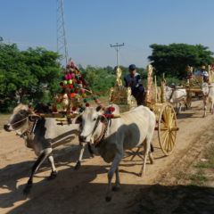
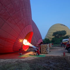
After the balloon flight earlier in the day, it was now time to get up even higher – this time climbing Mt. Popa (ပုပ္ပားတောင်) to a soaring 1518m above sea level.

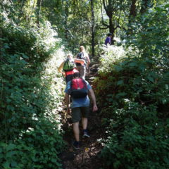
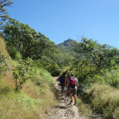
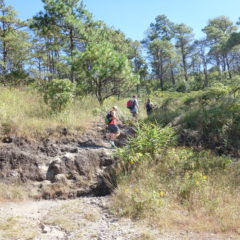
After (a second) breakfast we took a mini bus from our base in Nyaung U over to Popa village. Here we made it to the trail head and got going. An elevation gain of 900m was ahead of us; with the one-way distance provided as 11km (though – in reality we ended up taking shortcuts constantly, resulting in a quicker, but also steeper climb).

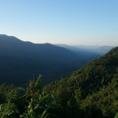
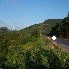
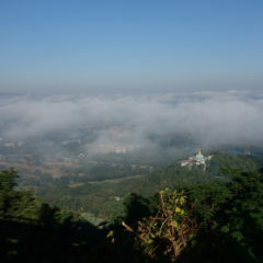
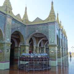
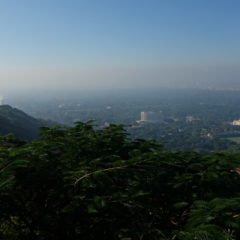
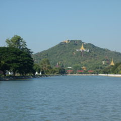
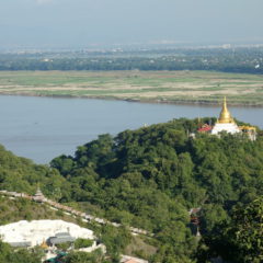
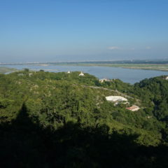
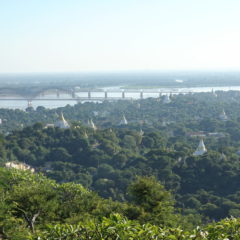
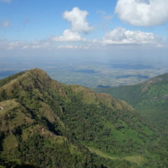
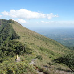
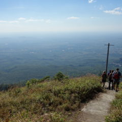
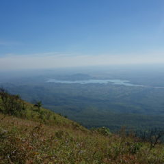
The hike started as a walk through the dense jungle, though after the half-way point it became gradually clearer and clearer and the trees smaller. We eventually had the first views of the surrounding area – including a direct via of the pedestal hill of Taung Kalat and the Tuyin Taung Pagoda on its top.

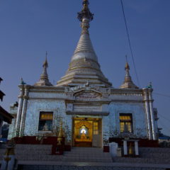
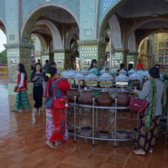
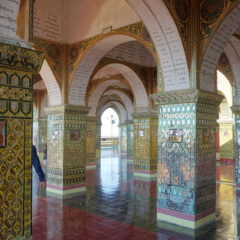
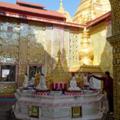
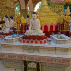
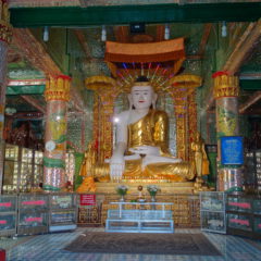
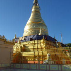
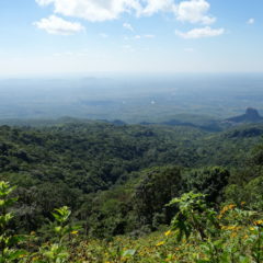
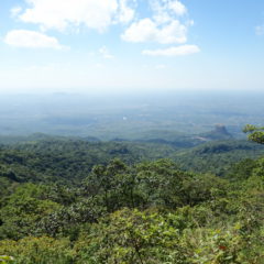
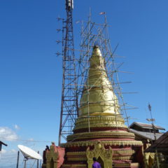
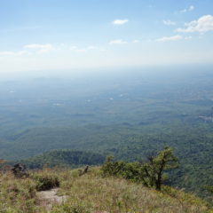
We continued higher and higher on Mt. Popa – until we eventually made it to the tree limit allowing for even better views. Views from the top were a disappointment, given that the top is used as a telecommunication station and as such is covered by all sorts of buildings. We also found a small stupa on top of the mountain, which made a good background for a late lunch.

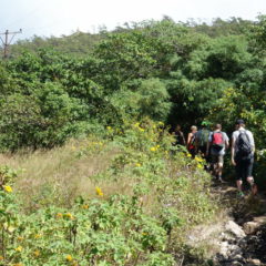
We made it back following the same way as on the way up. However as the bus was waiting for us at a different location, we were spared an altitude difference of around 200m.

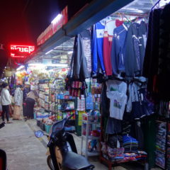
From Mt.Popa we made it back towards Nyaung U with a welcome stop at a swimming pool on the way to cool down after the hike; we made it back to the hotel well after dark.

Today has been a fairly busy day … from the adventure of a hot air balloon ride to the hike up a mountain – both providing great perspectives of the surrounding landscape – with a fairly close-by view from the balloon and the big picture from the top of Mt.Popa – overall a busy, but more than worthwhile day.